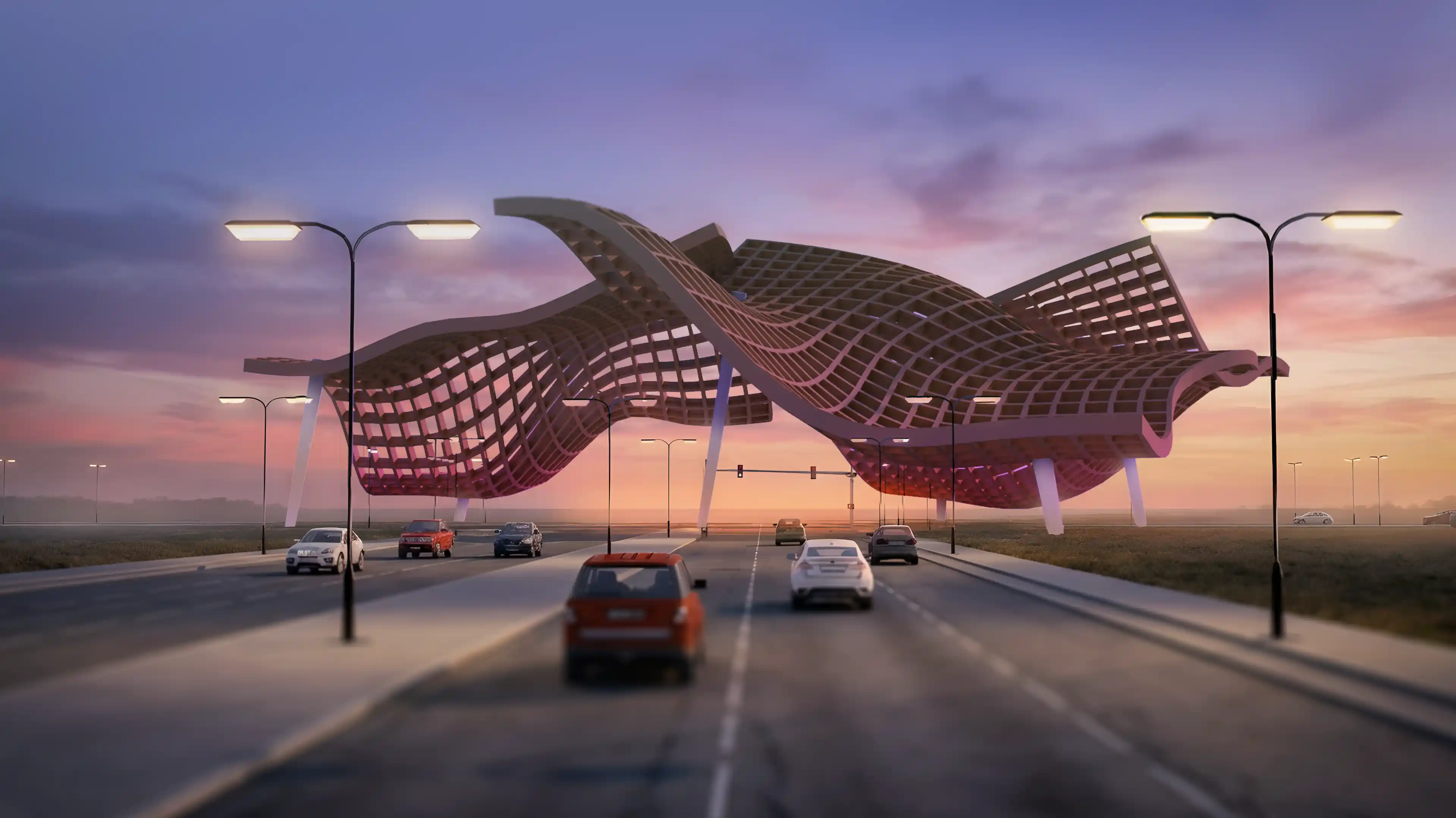

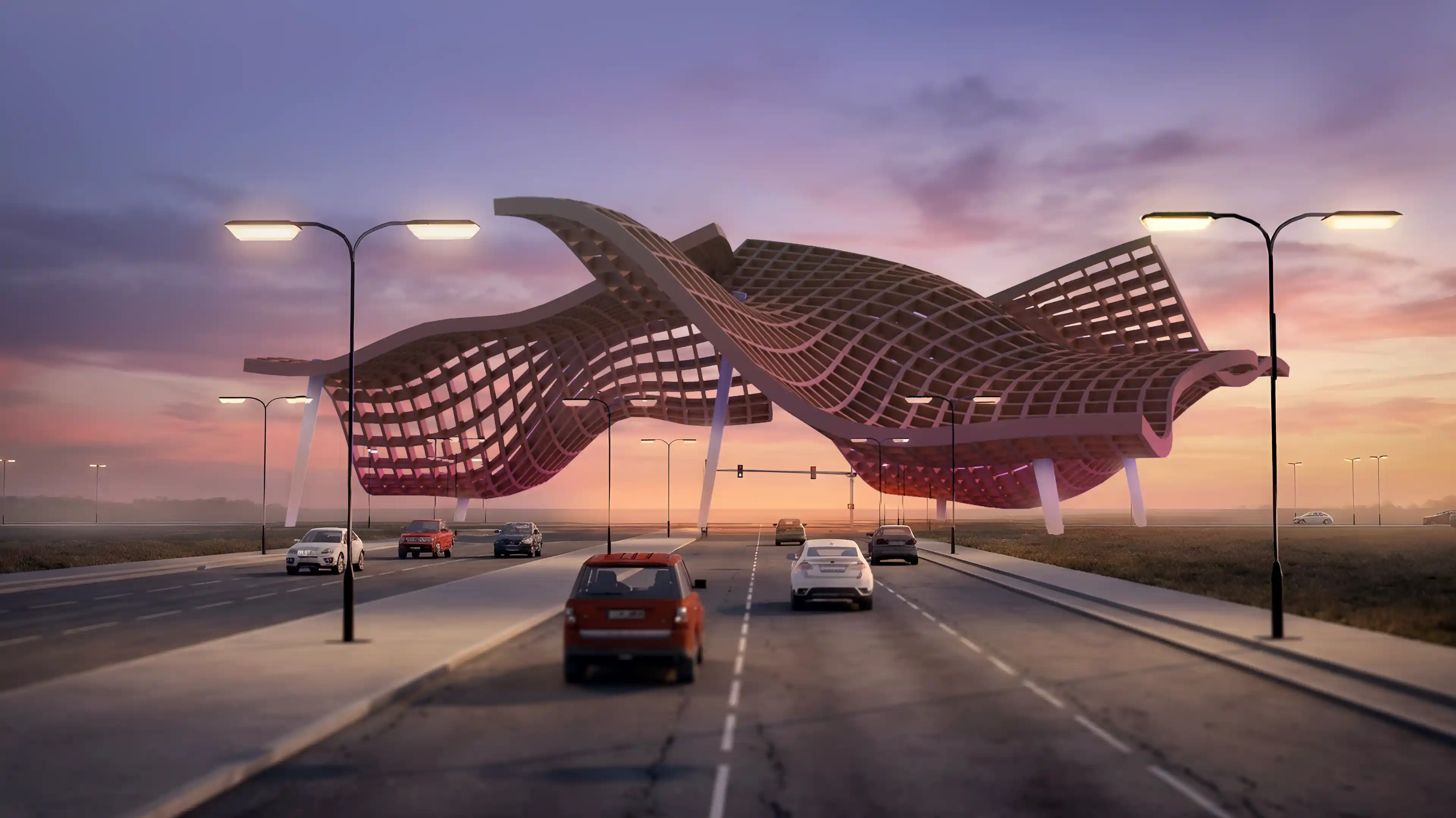
Arrival experience at Diyar Al Muharraq, Bahrain, as part of LIMAH's Masterplan wayfinding, public art, and user experience strategy
Case Study
/

Diyar Al Muharraq

Manama, Bahrain

Diyar Al Muharraq
2019
Case Study
/

Diyar Al Muharraq

Manama, Bahrain

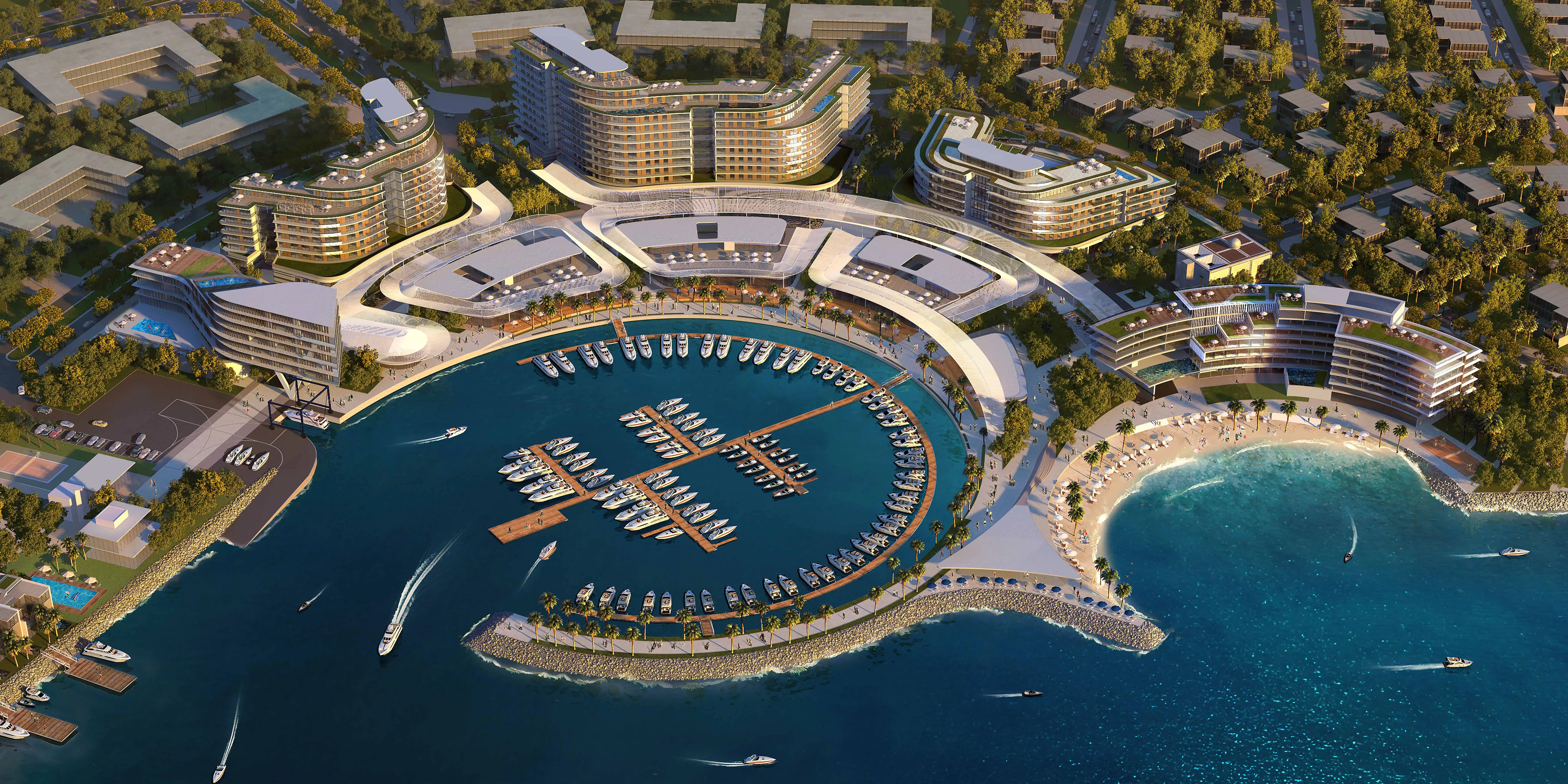
Located northeast of Manama, Diyar Al Muharraq is one of the Kingdom of Bahrain’s most ambitious urban developments, comprising a seven-island archipelago spanning more than 10 square kilometres of reclaimed land. Planned as a mixed-use destination for residential, hospitality, retail, civic, and recreational experiences, the development was envisioned as a place that supports both everyday living and long-term cultural connection.

We were appointed to develop the masterplan-scale wayfinding, public art, and user experience strategies across the development. Our role focused on creating a cohesive framework that supports intuitivenavigation while enriching the emotional and cultural identity of the destination through placemaking, storytelling, and experiential interventions.

Rather than treating navigation as signage alone, thestrategy approached wayfinding as part of a broader public realm experience where movement, art, and identity work together to encourage exploration,strengthen community, and create memorable moments across the islands.


STRATEGIC DRIVERS

  • Deliver intuitive and legible navigation across a multi-island development
  • Encourage exploration and discovery throughout districts and waterfronts
  • Foster strong community identity through culturally rooted placemaking
  • Integrate public art, wayfinding, and public realm strategies into one cohesive experience
  • Develop a scalable framework adaptable to future growth and evolving districts
EXPERIENCE STRATEGY AND DESIGN

MOVEMENT ACROSS THE ISLANDS

We began by studying how residents, visitors, and service users would mentally understand and navigate a development of this scale. The seven-island masterplan was organised into a clear north-south cognitive framework that establishes a strong spatial structure across the wider destination.

Destinations were categorised hierarchically into primary, secondary, and tertiary scales, ranging from island-wide attractions and district centres down to neighbourhood streets and local destinations. This hierarchy informed arrival sequences, roadway guidance, public realm orientation, and destination messaging throughout the development.

The result is a navigational framework that allows users to progressively understand where they are and where they are heading without relying on excessive visual information.

‍

CULTURAL IDENTITY AS A NAVIGATIONAL TOOL

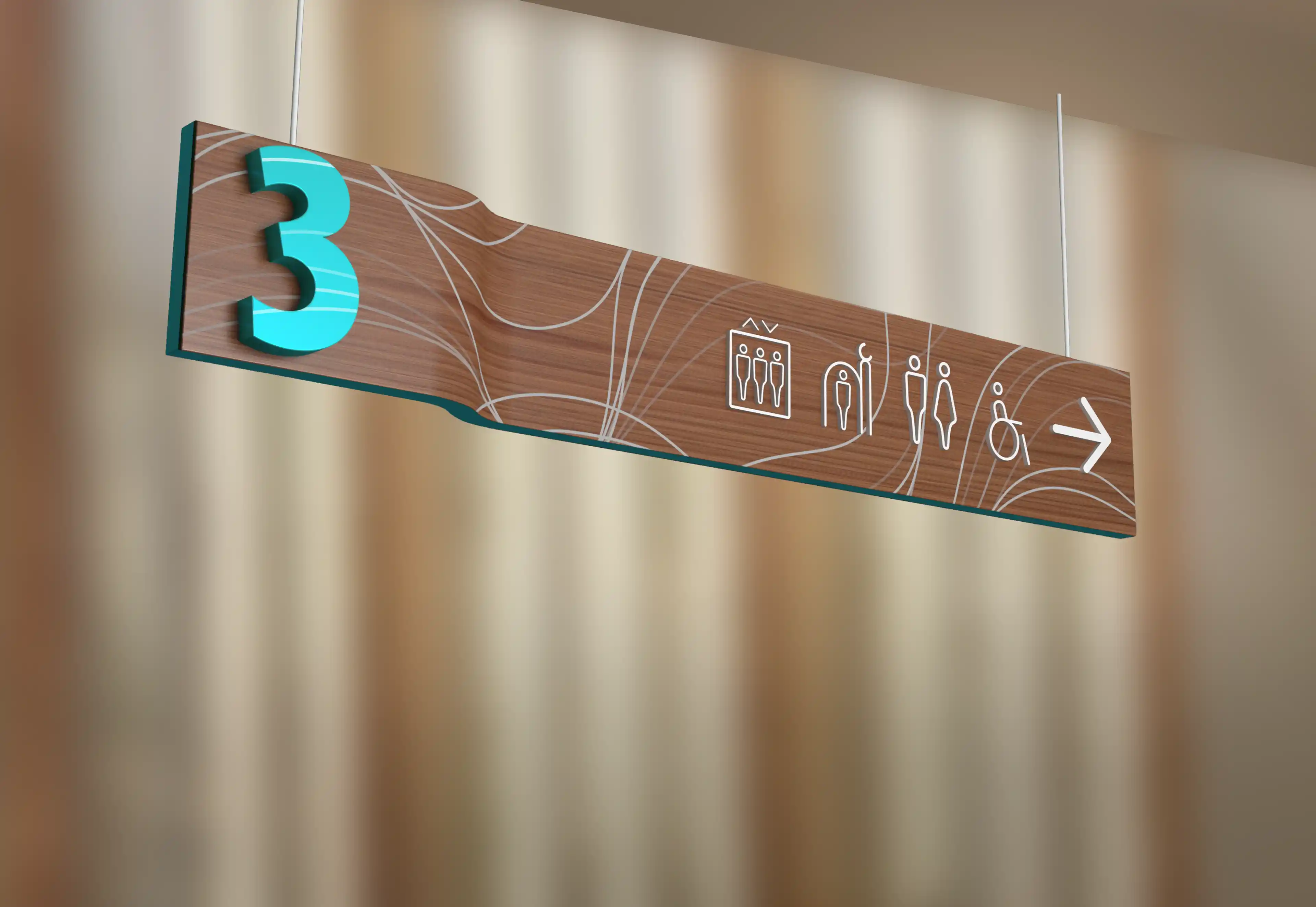
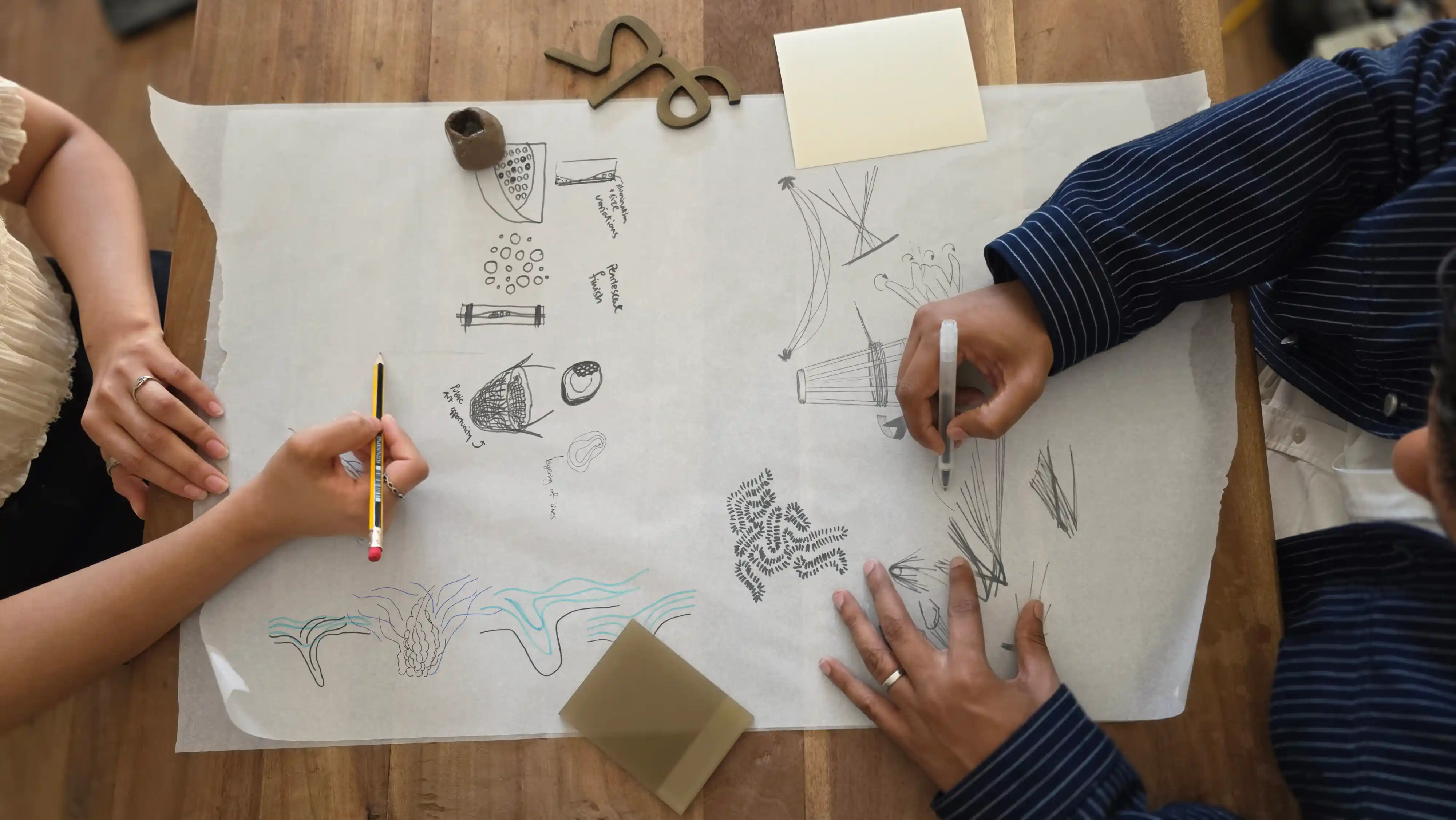
The visual and experiential language of the project draws heavily from Bahrain’s environmental and cultural heritage. Four themes informed the broader wayfinding and public art strategy: pearling traditions, submarine freshwater springs, coral formations, and the intricate weaving practices associated with Kurar craftsmanship.

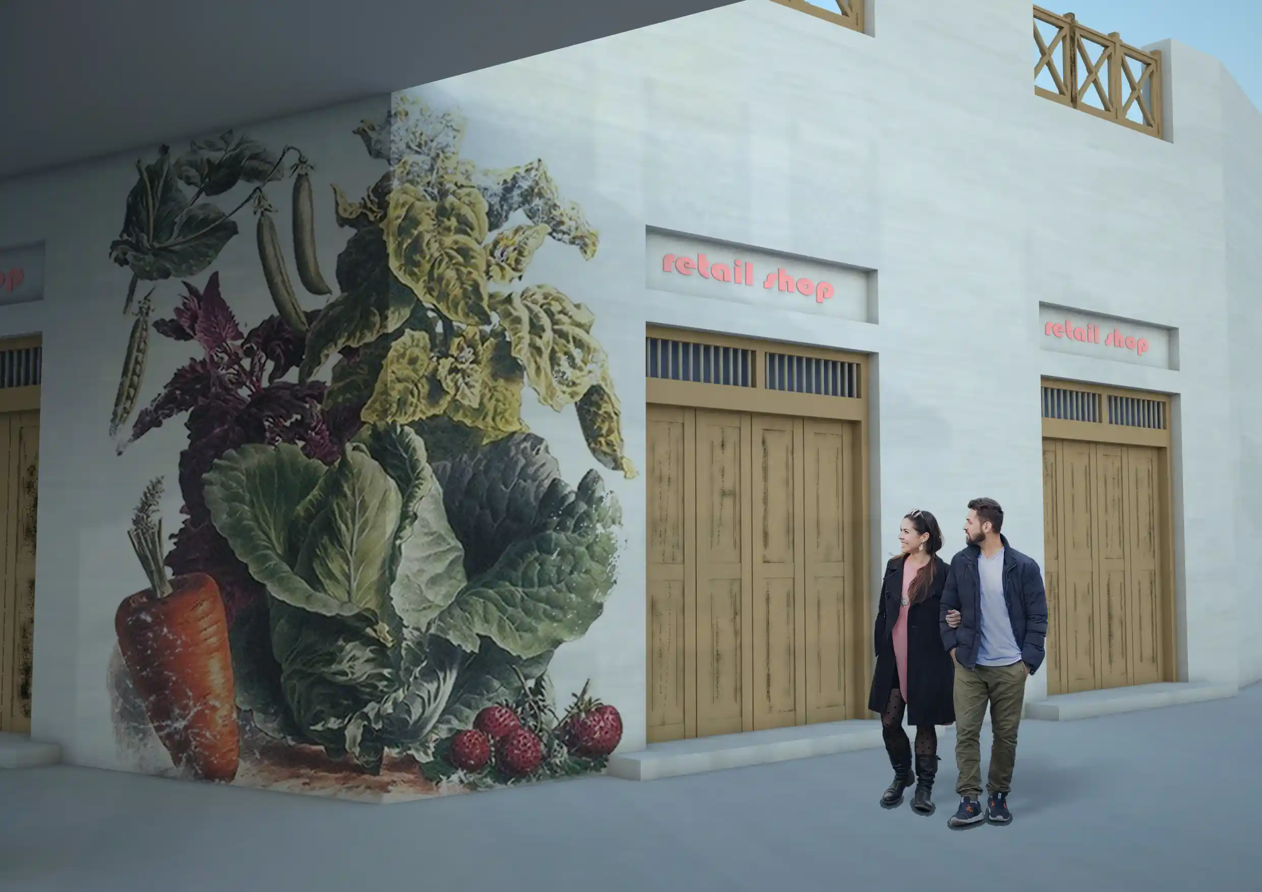
These references shaped both the visual language and the experiential qualities of the masterplan. Fluid forms, layered textures, and intricate detailing were explored as ways of embedding local identity into the navigation experience while creating environments that feel culturally grounded and memorable.

By integrating these narratives into the spatial experience, the development gains a stronger sense of place while allowing each district to express its own distinct character within the larger framework.

‍

‍

FEATURE MOMENT

PUBLIC ART STRATEGY

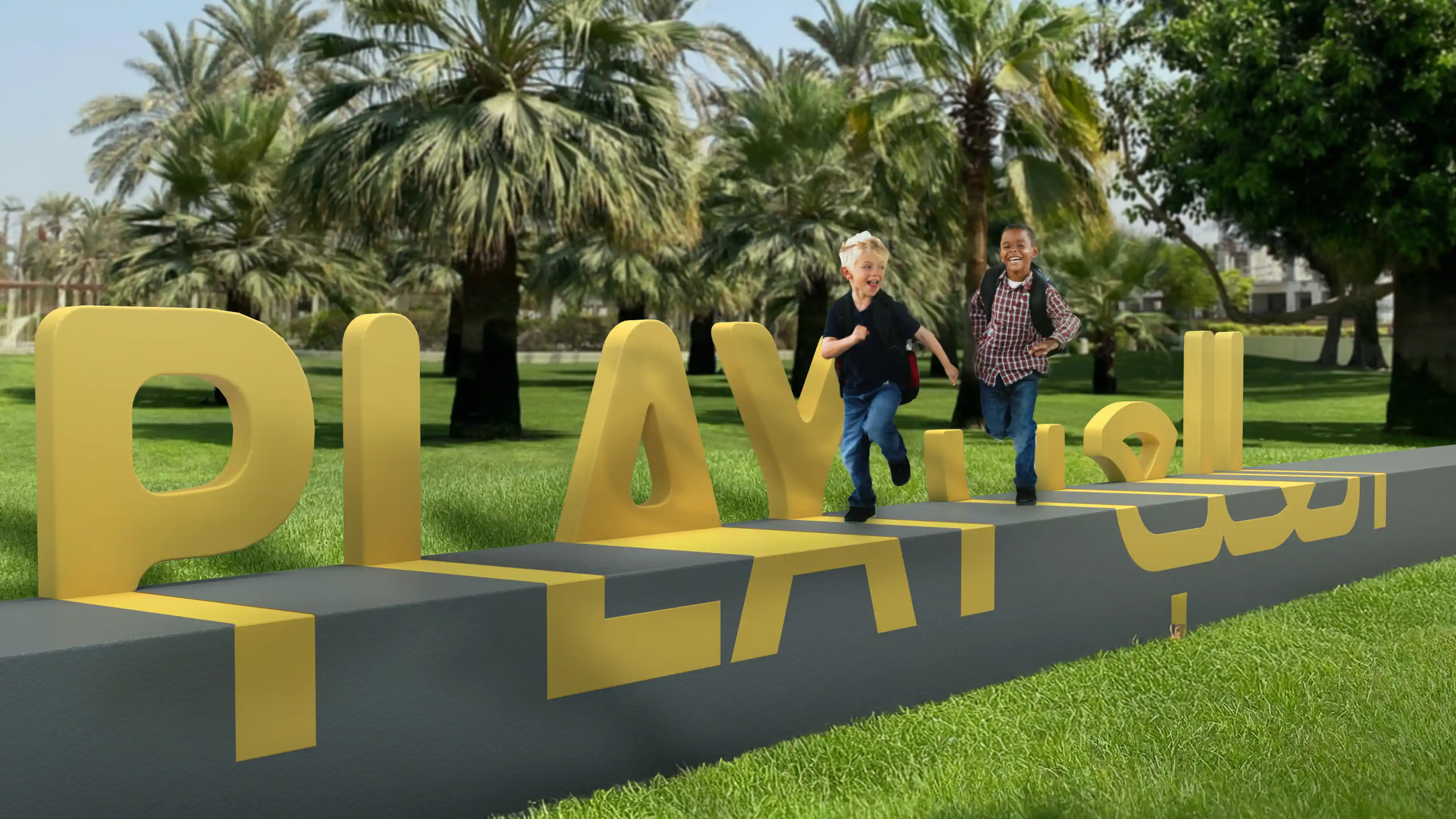
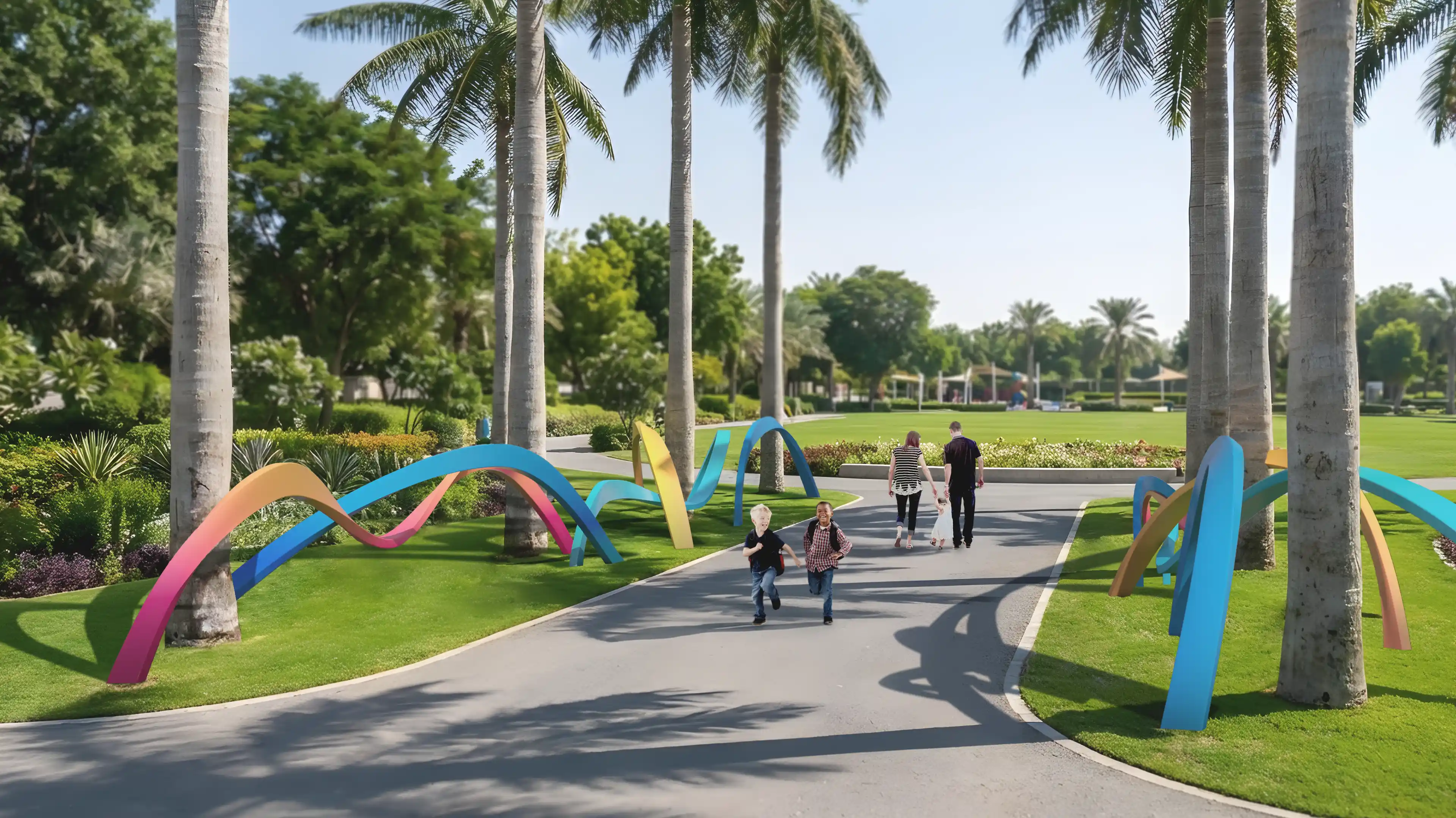
The strategy behind the Public Art was developed as a response to Diyar Al Muharraq’s unique architectural and physical context. To achieve this, we reviewed the site masterplan to identify the suitable areas for public art opportunities. Within each location, we broke down the types of public art that would best fit the surrounding context. Large scale interventions marked key gateways, bridges, intersections, and roundabouts, acting as landmarks and orientation cues. Smaller scale artworks were integrated into parks, mosque plazas, and community spaces to create local identity at a human scale.

Artworks were designed to encourage social interaction, photography, and digital engagement, creating moments that extend beyond the physical environment into social media and cultural memory.  People of all ages like to explore their neighbourhood and areas beyond. If an art piece is produced with local engagement, either through working with a local artist, going through a community consultation process, or having local history incorporated into the piece, there can be a strengthened sense of local pride and feeling of shared ownership in the community.

‍

‍

MASTERPLAN DESTINATIONS

The masterplan wayfinding strategy was implemented across multiple destinations within Diyar Al Muharraq, with each area adopting the overarching framework while responding to its distinct context, audience, and functional requirements.

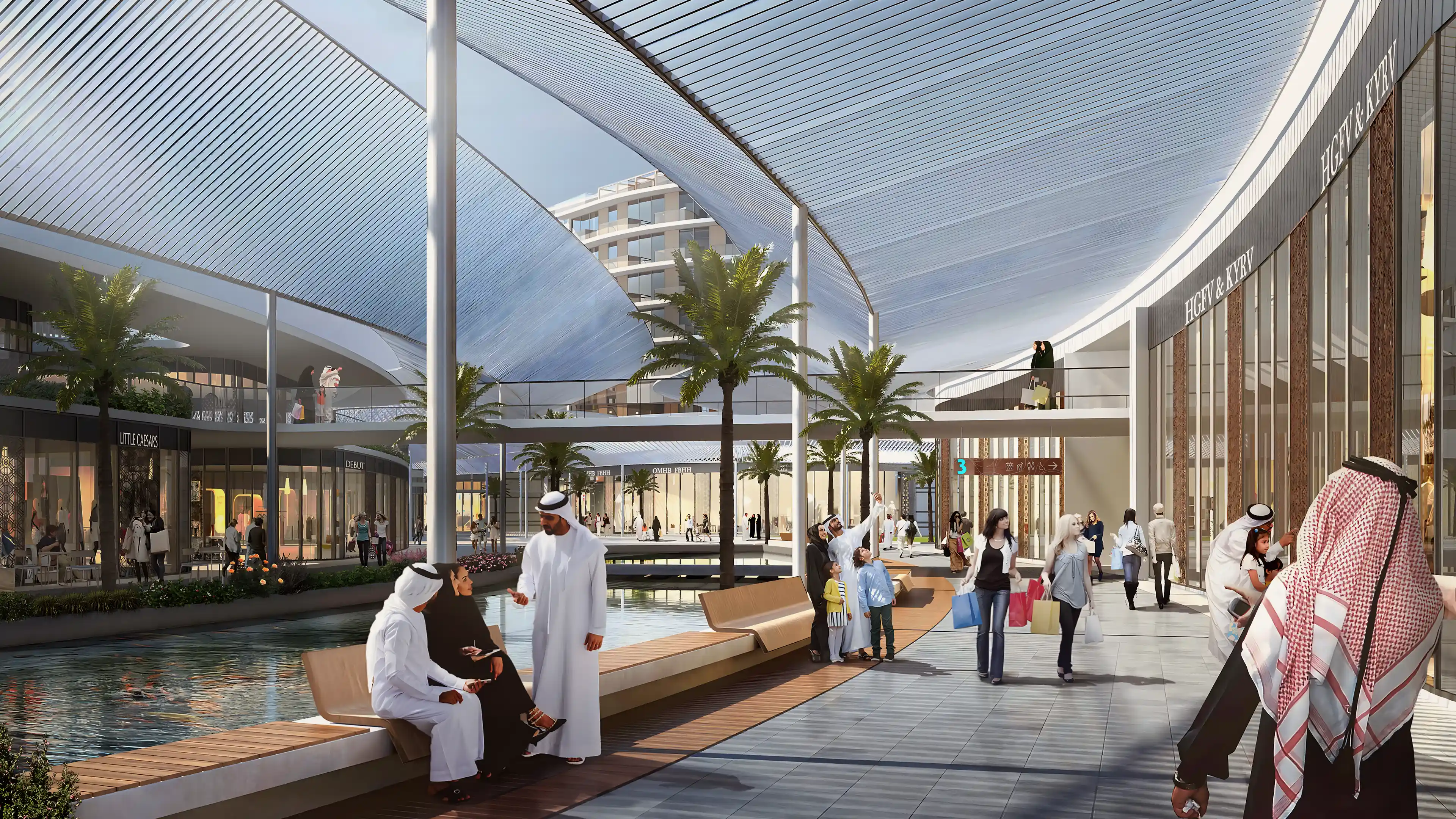
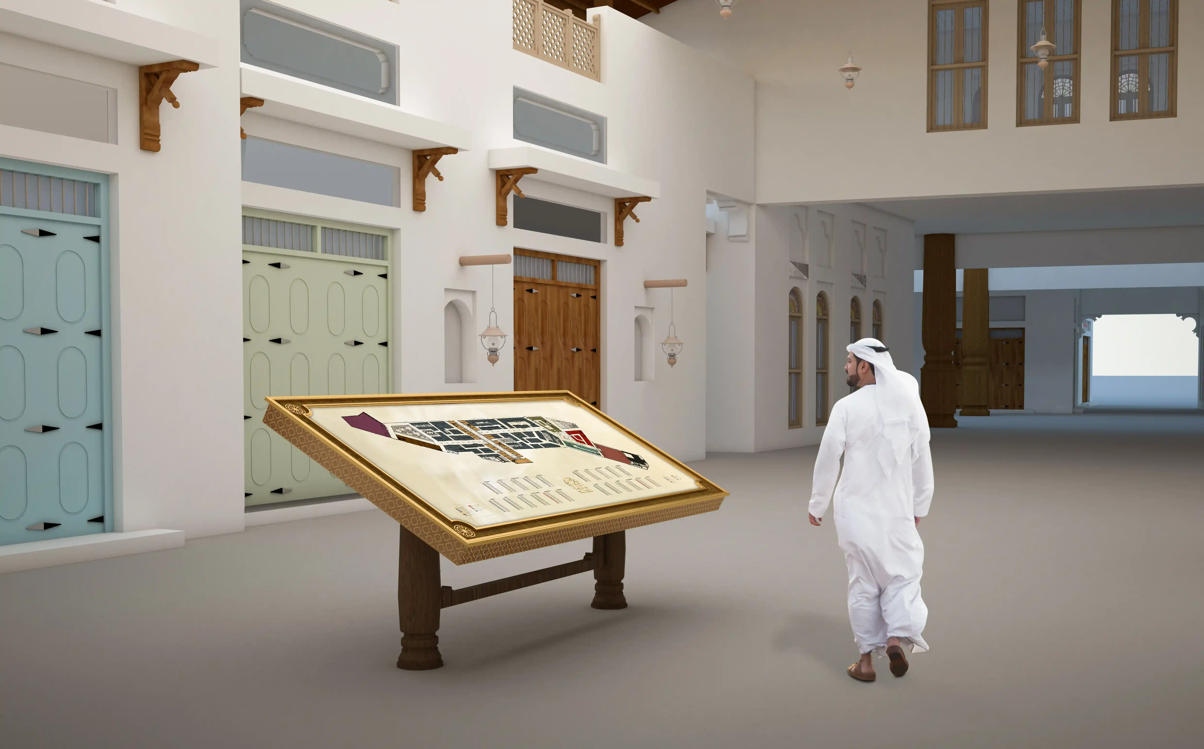
These destinations included Al Naseem, a gated residential community incorporating a waterfront retail and marina precinct; Diyar Park, serving as a central public open space; Al Oyoun Plaza, a neighbourhood retail centre; Souq Al Baraha, a traditional retail and leisure destination; and the Dragon Mart business areas, supporting commercial and trade-related uses.

No items found.

The Diyar Al Muharraq wayfinding and public art strategy establishes a cohesive and culturally rooted framework across one of Bahrain’s most ambitious urban developments. By integrating navigation, placemaking, and storytelling into a unified experience, the project transforms movement through the city into moments of discovery, connection, and exceptional human experiences.

Arrival experience at Diyar Al Muharraq, Bahrain, as part of LIMAH's Masterplan wayfinding, public art, and user experience strategy
Case Study
/

Diyar Al Muharraq

Manama, Bahrain

Diyar Al Muharraq
2019
Case Study
/

Diyar Al Muharraq

Manama, Bahrain

Located northeast of Manama, Diyar Al Muharraq is one of the Kingdom of Bahrain’s most ambitious urban developments, comprising a seven-island archipelago spanning more than 10 square kilometres of reclaimed land. Planned as a mixed-use destination for residential, hospitality, retail, civic, and recreational experiences, the development was envisioned as a place that supports both everyday living and long-term cultural connection.

We were appointed to develop the masterplan-scale wayfinding, public art, and user experience strategies across the development. Our role focused on creating a cohesive framework that supports intuitivenavigation while enriching the emotional and cultural identity of the destination through placemaking, storytelling, and experiential interventions.

Rather than treating navigation as signage alone, thestrategy approached wayfinding as part of a broader public realm experience where movement, art, and identity work together to encourage exploration,strengthen community, and create memorable moments across the islands.


STRATEGIC DRIVERS

  • Deliver intuitive and legible navigation across a multi-island development
  • Encourage exploration and discovery throughout districts and waterfronts
  • Foster strong community identity through culturally rooted placemaking
  • Integrate public art, wayfinding, and public realm strategies into one cohesive experience
  • Develop a scalable framework adaptable to future growth and evolving districts
EXPERIENCE STRATEGY AND DESIGN

MOVEMENT ACROSS THE ISLANDS

We began by studying how residents, visitors, and service users would mentally understand and navigate a development of this scale. The seven-island masterplan was organised into a clear north-south cognitive framework that establishes a strong spatial structure across the wider destination.

Destinations were categorised hierarchically into primary, secondary, and tertiary scales, ranging from island-wide attractions and district centres down to neighbourhood streets and local destinations. This hierarchy informed arrival sequences, roadway guidance, public realm orientation, and destination messaging throughout the development.

The result is a navigational framework that allows users to progressively understand where they are and where they are heading without relying on excessive visual information.

‍

CULTURAL IDENTITY AS A NAVIGATIONAL TOOL

The visual and experiential language of the project draws heavily from Bahrain’s environmental and cultural heritage. Four themes informed the broader wayfinding and public art strategy: pearling traditions, submarine freshwater springs, coral formations, and the intricate weaving practices associated with Kurar craftsmanship.

These references shaped both the visual language and the experiential qualities of the masterplan. Fluid forms, layered textures, and intricate detailing were explored as ways of embedding local identity into the navigation experience while creating environments that feel culturally grounded and memorable.

By integrating these narratives into the spatial experience, the development gains a stronger sense of place while allowing each district to express its own distinct character within the larger framework.

‍

‍

No items found.

FEATURE MOMENT

PUBLIC ART STRATEGY

The strategy behind the Public Art was developed as a response to Diyar Al Muharraq’s unique architectural and physical context. To achieve this, we reviewed the site masterplan to identify the suitable areas for public art opportunities. Within each location, we broke down the types of public art that would best fit the surrounding context. Large scale interventions marked key gateways, bridges, intersections, and roundabouts, acting as landmarks and orientation cues. Smaller scale artworks were integrated into parks, mosque plazas, and community spaces to create local identity at a human scale.

Artworks were designed to encourage social interaction, photography, and digital engagement, creating moments that extend beyond the physical environment into social media and cultural memory.  People of all ages like to explore their neighbourhood and areas beyond. If an art piece is produced with local engagement, either through working with a local artist, going through a community consultation process, or having local history incorporated into the piece, there can be a strengthened sense of local pride and feeling of shared ownership in the community.

‍

‍

MASTERPLAN DESTINATIONS

The masterplan wayfinding strategy was implemented across multiple destinations within Diyar Al Muharraq, with each area adopting the overarching framework while responding to its distinct context, audience, and functional requirements.

These destinations included Al Naseem, a gated residential community incorporating a waterfront retail and marina precinct; Diyar Park, serving as a central public open space; Al Oyoun Plaza, a neighbourhood retail centre; Souq Al Baraha, a traditional retail and leisure destination; and the Dragon Mart business areas, supporting commercial and trade-related uses.

No items found.

The Diyar Al Muharraq wayfinding and public art strategy establishes a cohesive and culturally rooted framework across one of Bahrain’s most ambitious urban developments. By integrating navigation, placemaking, and storytelling into a unified experience, the project transforms movement through the city into moments of discovery, connection, and exceptional human experiences.

Arrival experience at Diyar Al Muharraq, Bahrain, as part of LIMAH's Masterplan wayfinding, public art, and user experience strategy
Case Study
/

Diyar Al Muharraq

Manama, Bahrain

PUBLIC ART
/
LA MER
2023
Case Study
/

Diyar Al Muharraq

Manama, Bahrain

YEAR
2019
CLIENT
Diyar Al Muharraq WLL
LOCATION
Manama, Bahrain
SERVICES
Experience Strategy
,
Wayfinding & Navigation
,
Place Identity & Public Art
,
Built Environment Integration
,
SECTOR
Cities & Masterplans
,
Parks & Public Realm
,
Retail
,
SHARE BY
https://pb-cb6cbd.webflow.io/projects/diyar-al-muharraq

Located northeast of Manama, Diyar Al Muharraq is one of the Kingdom of Bahrain’s most ambitious urban developments, comprising a seven-island archipelago spanning more than 10 square kilometres of reclaimed land. Planned as a mixed-use destination for residential, hospitality, retail, civic, and recreational experiences, the development was envisioned as a place that supports both everyday living and long-term cultural connection.

We were appointed to develop the masterplan-scale wayfinding, public art, and user experience strategies across the development. Our role focused on creating a cohesive framework that supports intuitivenavigation while enriching the emotional and cultural identity of the destination through placemaking, storytelling, and experiential interventions.

Rather than treating navigation as signage alone, thestrategy approached wayfinding as part of a broader public realm experience where movement, art, and identity work together to encourage exploration,strengthen community, and create memorable moments across the islands.


STRATEGIC DRIVERS

  • Deliver intuitive and legible navigation across a multi-island development
  • Encourage exploration and discovery throughout districts and waterfronts
  • Foster strong community identity through culturally rooted placemaking
  • Integrate public art, wayfinding, and public realm strategies into one cohesive experience
  • Develop a scalable framework adaptable to future growth and evolving districts
No items found.

MOVEMENT ACROSS THE ISLANDS

We began by studying how residents, visitors, and service users would mentally understand and navigate a development of this scale. The seven-island masterplan was organised into a clear north-south cognitive framework that establishes a strong spatial structure across the wider destination.

Destinations were categorised hierarchically into primary, secondary, and tertiary scales, ranging from island-wide attractions and district centres down to neighbourhood streets and local destinations. This hierarchy informed arrival sequences, roadway guidance, public realm orientation, and destination messaging throughout the development.

The result is a navigational framework that allows users to progressively understand where they are and where they are heading without relying on excessive visual information.

‍

CULTURAL IDENTITY AS A NAVIGATIONAL TOOL

The visual and experiential language of the project draws heavily from Bahrain’s environmental and cultural heritage. Four themes informed the broader wayfinding and public art strategy: pearling traditions, submarine freshwater springs, coral formations, and the intricate weaving practices associated with Kurar craftsmanship.

These references shaped both the visual language and the experiential qualities of the masterplan. Fluid forms, layered textures, and intricate detailing were explored as ways of embedding local identity into the navigation experience while creating environments that feel culturally grounded and memorable.

By integrating these narratives into the spatial experience, the development gains a stronger sense of place while allowing each district to express its own distinct character within the larger framework.

‍

‍

No items found.