
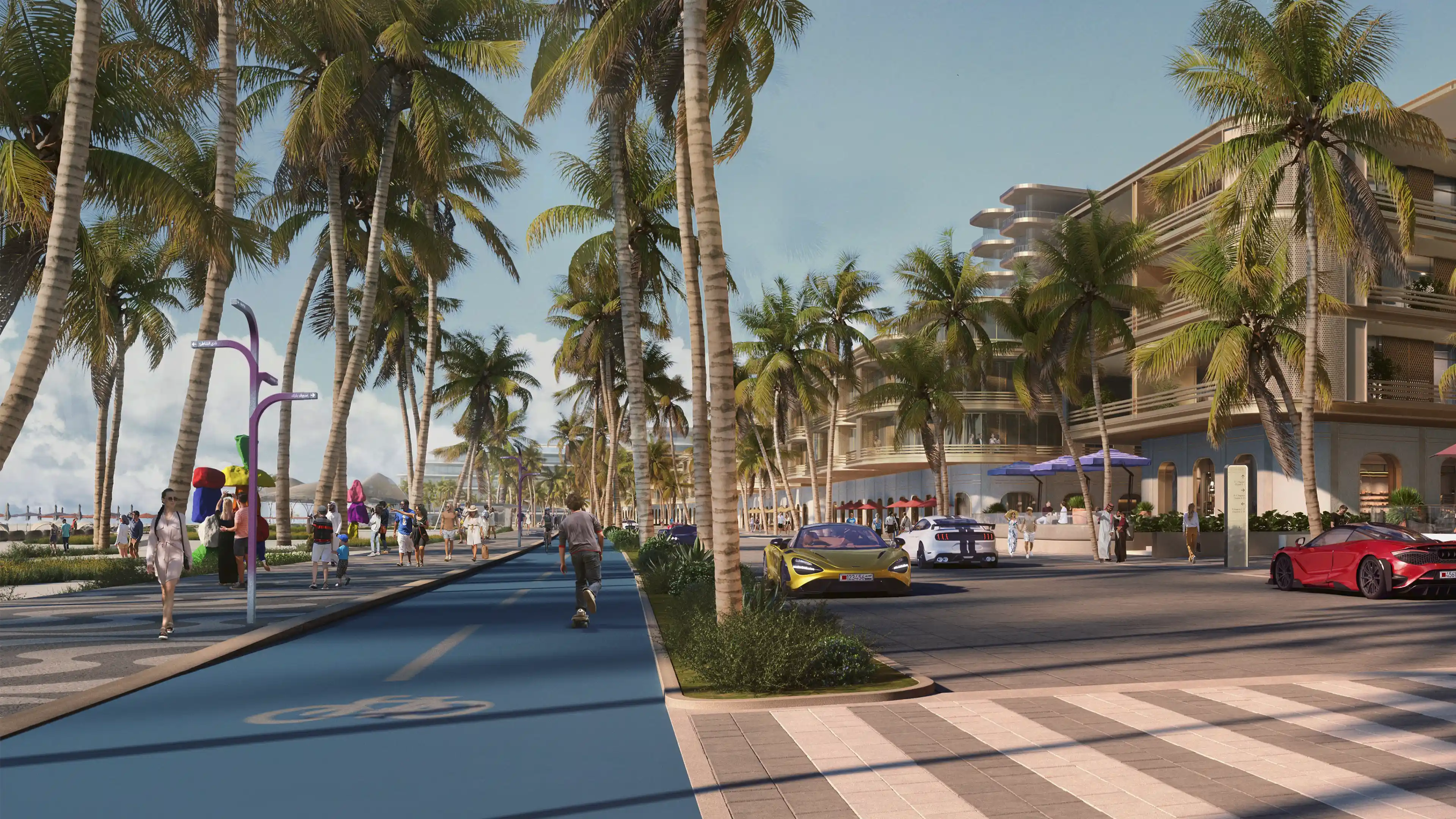
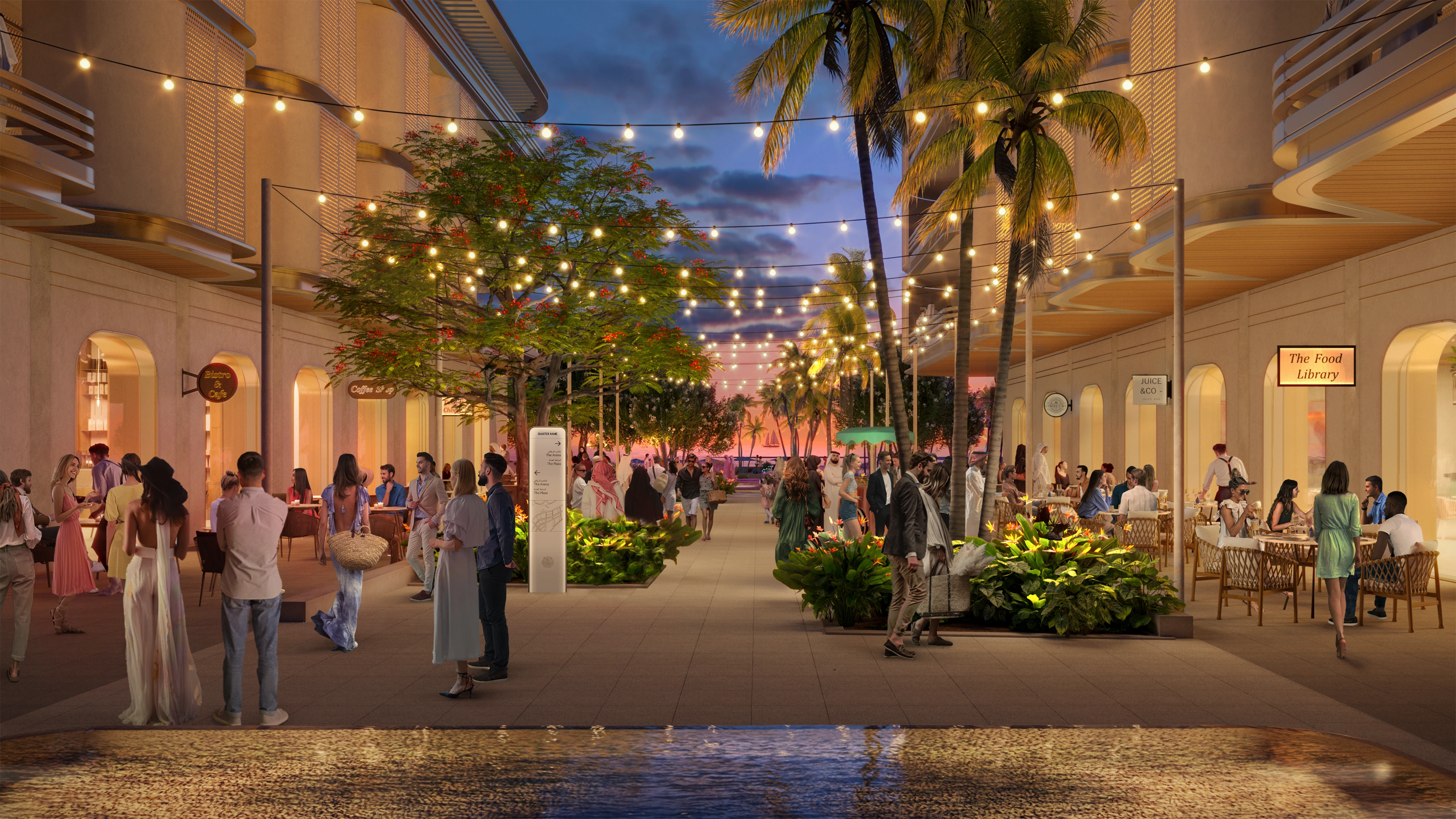
People navigating Ocean Drive at Bilaj Al Jazayer using LIMAH's integrated wayfinding and signage system
Case Study
/

Bilaj Al Jazayer

Bahrain

Bilaj Al Jazayer
2024
Case Study
/

Bilaj Al Jazayer

Bahrain

Bilaj Al Jazayer is a 3.5 kilometre coastal masterplan on Bahrain's southwest shoreline, conceived as a mixed destination of hospitality, residential living, retail, food and beverage, and beachfront leisure. Developed in collaboration with Foster + Partners, the project is structured through three primary axes that organize movement, activity, and identity across the site: the Beach Boulevard, the Retail Street, and the Central Spine. Rooted in Bahraini values and informed by the energy of Miami Art Deco, the vision brings together active public life, curated beachfront experiences, and more private residential character within one unified masterplan.

For Bilaj Al Jazayer, LIMAH's approach developed a wayfinding ecosystem directly from the masterplan's spatial and experiential structure, allowing streets, piers, and character areas to define how the destination was read, named, and understood. Across Beachfront, Urban Living, and Community Living, the system carried one coherent language through a controlled shift in expression, moving from the vibrancy of Miami Art Deco at the beachfront to the quieter and more screened character of Bahraini vernacular within the residential community.

‍

STRATEGIC DRIVERS

  • Translate the vibrancy of Miami Art Deco and the depth of Bahraini vernacular into one coherent wayfinding language, calibrated across public, urban, and residential conditions.
  • Shape the system around Beachfront, Urban Living, and Community Living, allowing each zone to carry a distinct expression while remaining part of one connected navigational ecosystem.
  • Use the masterplan's axes, road hierarchy, and beachfront orientation to establish a strong cognitive map across a long and highly programmed coastal destination.
  • Allow streets, piers, zones, and hierarchy to define how places are named, addressed, and remembered, making the spatial logic of the masterplan part of the wayfinding strategy itself.
  • Calibrate the wayfinding experience across active public life, urban intensity, and quieter residential character, aligning information, expression, and identity with changing levels of access, privacy, and use.
‍

EXPERIENCE STRATEGY AND DESIGN

Signage Through Character Zoning

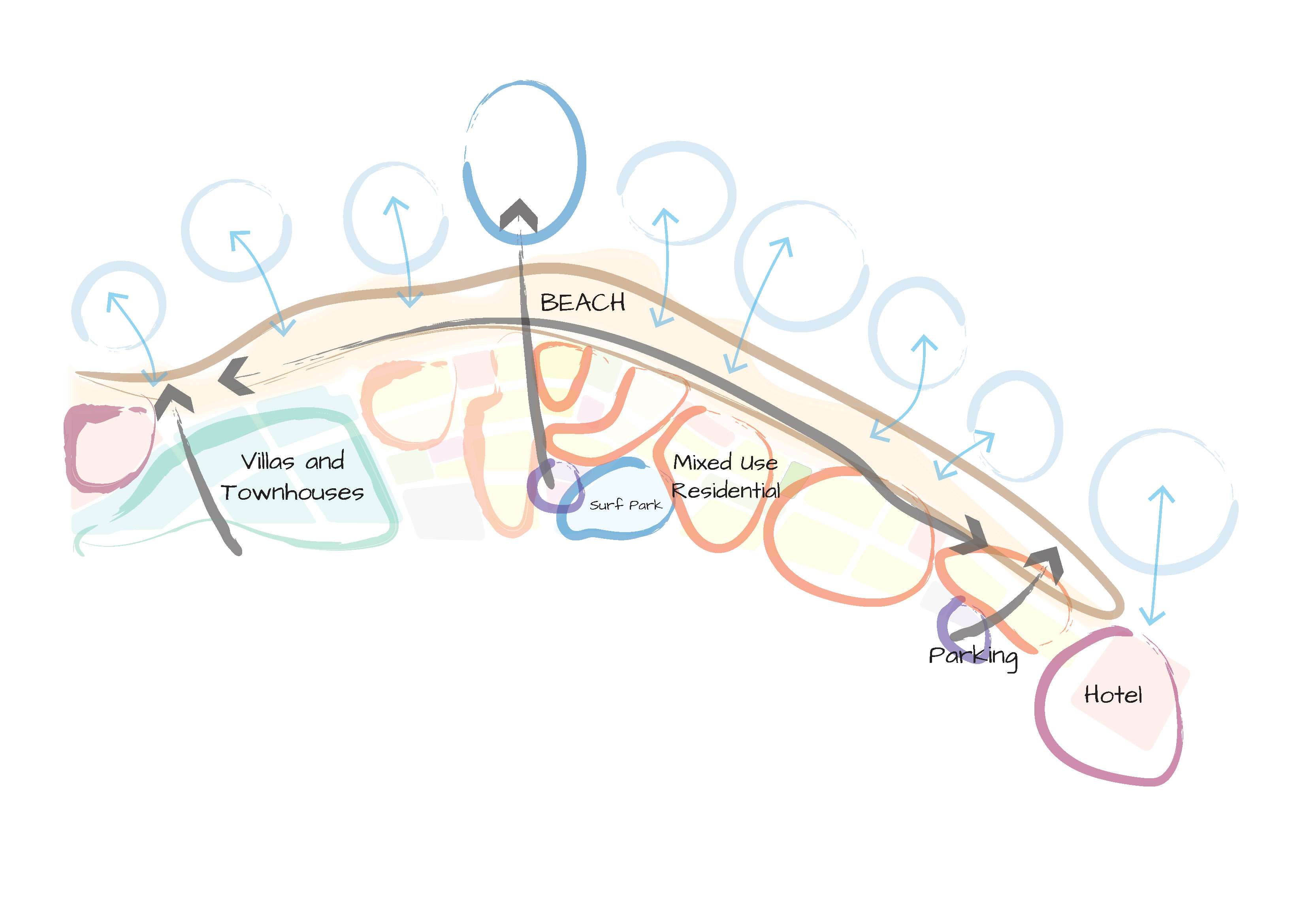
The masterplan is the culmination of a unique contextual interplay of Beachfront, Urban Living, and Community Living, creating three distinctive character zones. These character zones define the experience within them and in relation to each other. The signage approach directly speaks to these character zones, carrying one coherent family across the masterplan while responding in proportion, expression, material, and detail as it moves between the three conditions. The result is a system that reads as a single identity and adapts as the context adapts.We grounded our strategy in an understanding of user behaviour, movement patterns, and environmental cues. By mapping key touchpoints and journey sequences, we established a cognitive framework that supports orientation from the first point of arrival. We analysed the site’s three primary axes and their roles in visitor flow, and defined how these elements guide movement from regional access roads through the main boulevard and ultimately to the beachfront.

‍

Nomenclature Derived from the Spatial Structure

The addressing and naming system is drawn directly from the masterplan itself. Streets, piers, and zones become the material for nomenclature. Pier-anchored avenues carry identity inland from the water, while nature-derived zone names give the length of the site a familiar rhythm. The masterplan's spatial logic becomes the wayfinding strategy itself, so that every name and address emerges from the plan and returns the user to it each time they read a sign.

‍

A Graded Expression from Public to Private

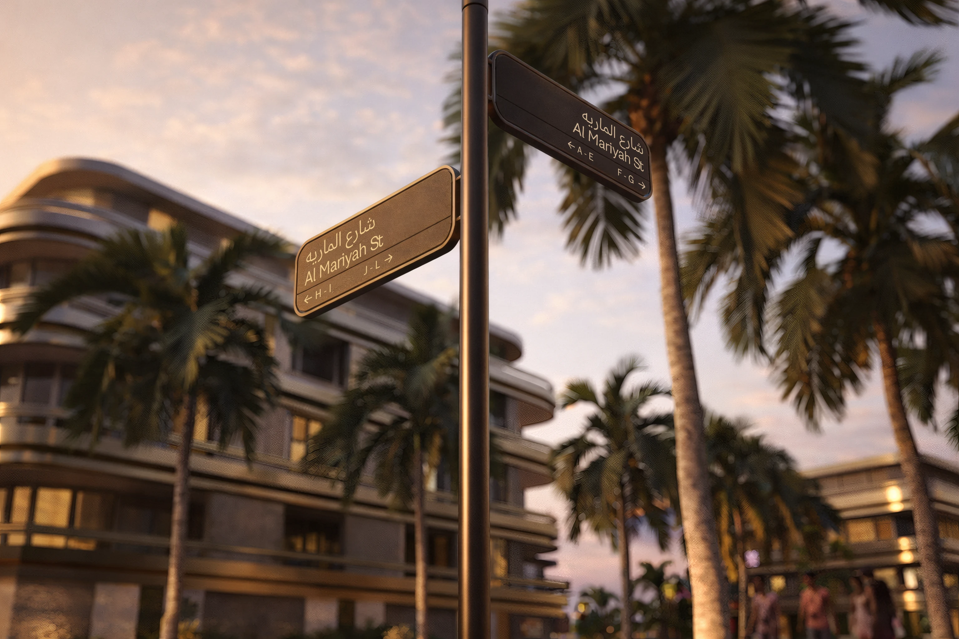
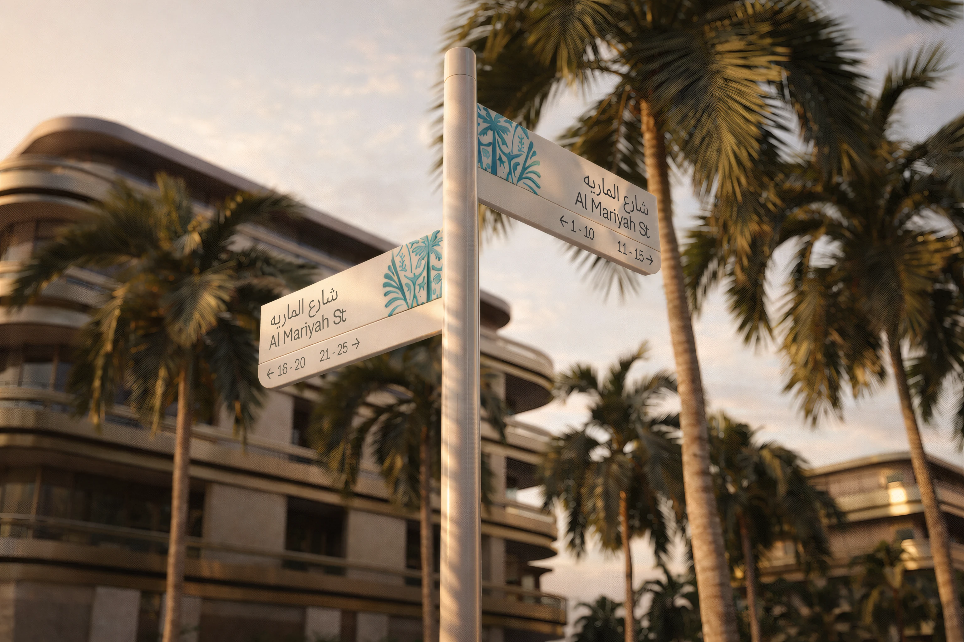
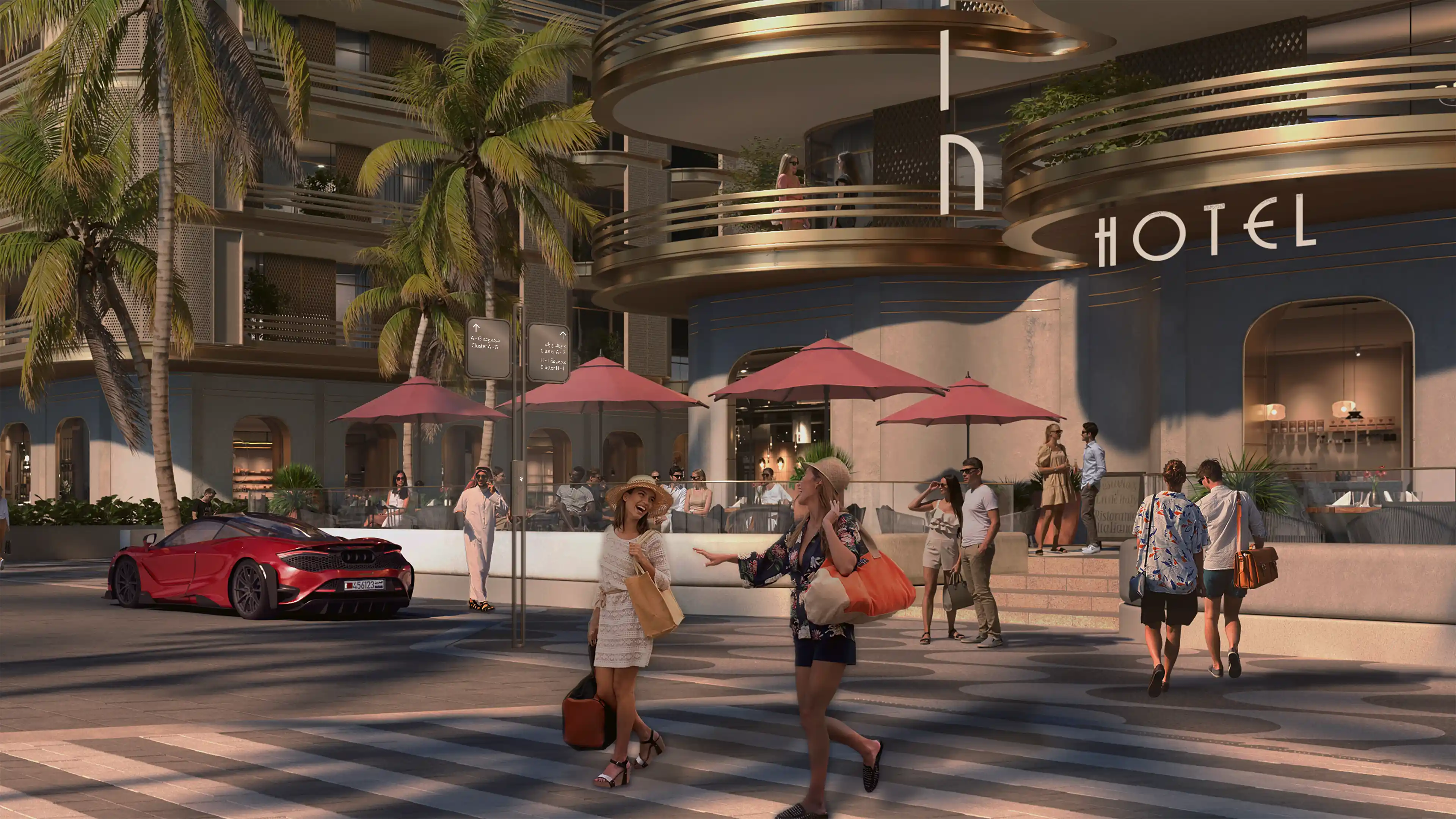
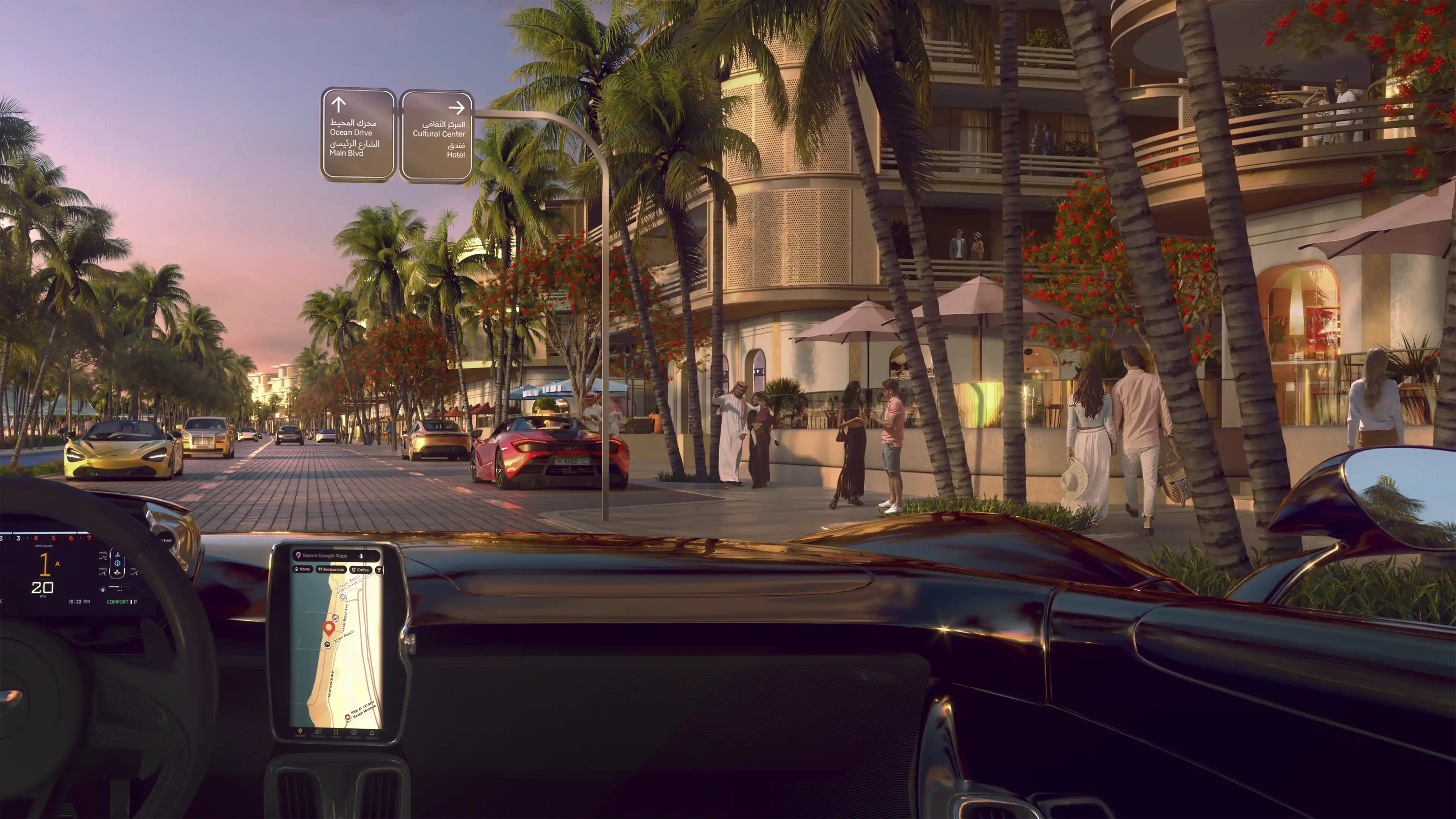
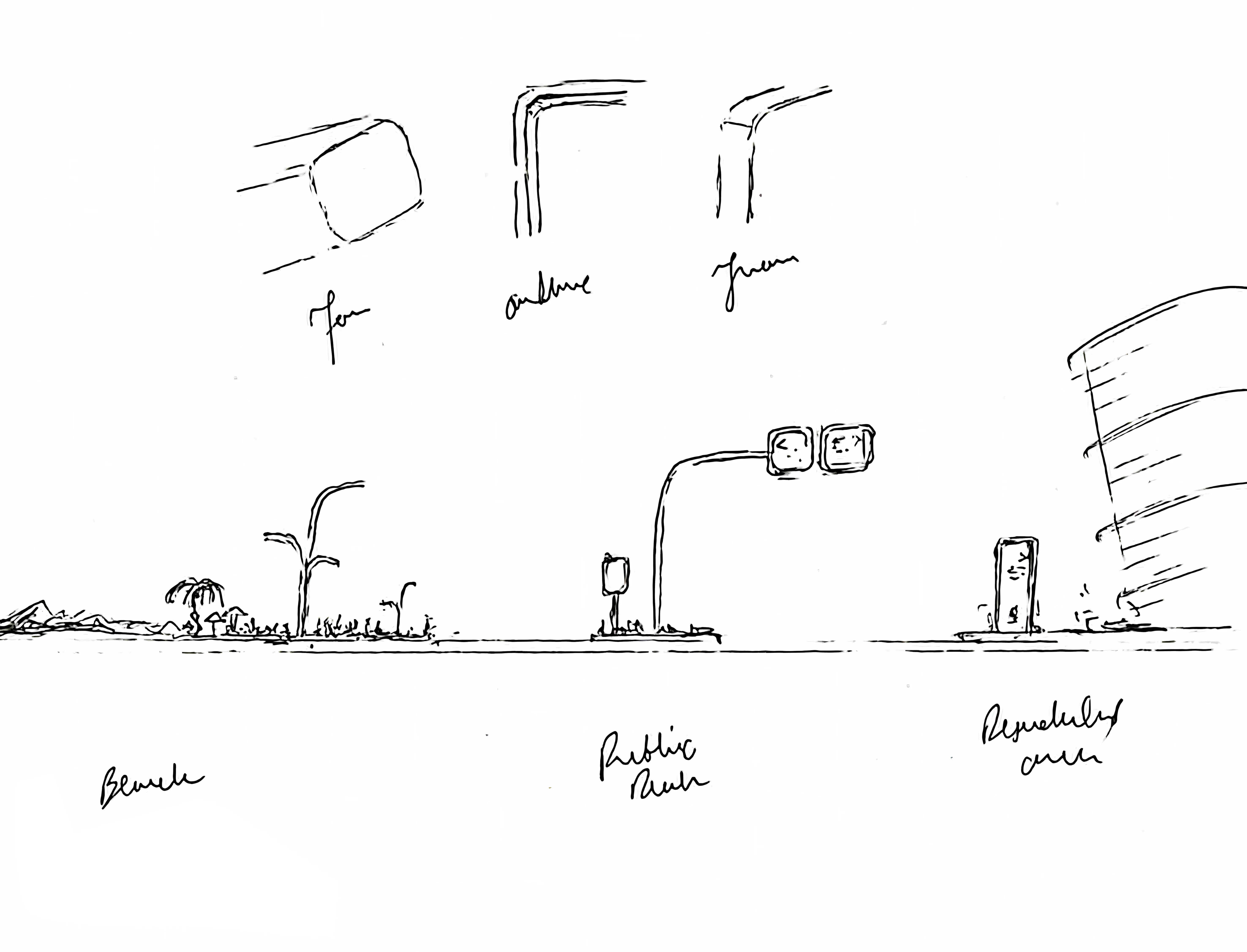
The masterplan unfolds as a gradient from the active Beachfront to the quieter and more screened Community Living. The wayfinding follows that gradient. Information density, expression, scale, and lighting are calibrated to the changing levels of access, privacy, and use. The signage along Ocean Drive is expressive and tuned for a public, visitor-led rhythm. The signage at the residential doorstep is quieter, more intimate, and carefully screened. The user moves through one consistent language that becomes more reserved as the context becomes more private.

FEATURE MOMENT

BEACHFRONT ARRIVAL

The project's first moment of identification sits at the beachfront, where Bilaj Al Jazayer introduces itself as a place. The Main ID stands as a large, confident feature sign, scaled to the openness of Ocean Drive and the horizon behind it. Its language carries the vibrancy of Miami Art Deco, translated through the proportions, palette, and materials of the Gulf. For the visitor arriving along the boulevard, from the hotel, or from the city, this is the moment the project introduces itself. It is the physical expression of Bilaj Al Jazayer's Miami narrative set within a Gulf context, and the first impression that sets the tone for the entire masterplan.

THE RESIDENTIAL THRESHOLD

The signage at the threshold of Community Living reads at a different tempo. Anchored in the Bahraini vernacular, the residential block identification is quieter in proportion, more screened in detail, and calibrated to the intimacy of the private realm. Where the beachfront sign celebrates horizon and arrival, this one marks entry into the more reserved character of the neighbourhood. It carries the same design family through a different weight and a different voice. For the resident returning home, the sign belongs to the environment as much as it guides movement through it.

No items found.

For Bilaj Al Jazayer, LIMAH shaped a wayfinding ecosystem derived from the masterplan’s own spatial logic, calibrated across character, hierarchy, identity, and user journey. From the energy of the beachfront to the quieter residential fabric, the approach unified orientation, naming, expression, and experience into one coherent navigational language that creates Exceptional Human Experiences.

People navigating Ocean Drive at Bilaj Al Jazayer using LIMAH's integrated wayfinding and signage system
Case Study
/

Bilaj Al Jazayer

Bahrain

Bilaj Al Jazayer
2024
Case Study
/

Bilaj Al Jazayer

Bahrain

Bilaj Al Jazayer is a 3.5 kilometre coastal masterplan on Bahrain's southwest shoreline, conceived as a mixed destination of hospitality, residential living, retail, food and beverage, and beachfront leisure. Developed in collaboration with Foster + Partners, the project is structured through three primary axes that organize movement, activity, and identity across the site: the Beach Boulevard, the Retail Street, and the Central Spine. Rooted in Bahraini values and informed by the energy of Miami Art Deco, the vision brings together active public life, curated beachfront experiences, and more private residential character within one unified masterplan.

For Bilaj Al Jazayer, LIMAH's approach developed a wayfinding ecosystem directly from the masterplan's spatial and experiential structure, allowing streets, piers, and character areas to define how the destination was read, named, and understood. Across Beachfront, Urban Living, and Community Living, the system carried one coherent language through a controlled shift in expression, moving from the vibrancy of Miami Art Deco at the beachfront to the quieter and more screened character of Bahraini vernacular within the residential community.

‍

STRATEGIC DRIVERS

  • Translate the vibrancy of Miami Art Deco and the depth of Bahraini vernacular into one coherent wayfinding language, calibrated across public, urban, and residential conditions.
  • Shape the system around Beachfront, Urban Living, and Community Living, allowing each zone to carry a distinct expression while remaining part of one connected navigational ecosystem.
  • Use the masterplan's axes, road hierarchy, and beachfront orientation to establish a strong cognitive map across a long and highly programmed coastal destination.
  • Allow streets, piers, zones, and hierarchy to define how places are named, addressed, and remembered, making the spatial logic of the masterplan part of the wayfinding strategy itself.
  • Calibrate the wayfinding experience across active public life, urban intensity, and quieter residential character, aligning information, expression, and identity with changing levels of access, privacy, and use.
‍

EXPERIENCE STRATEGY AND DESIGN

Signage Through Character Zoning

The masterplan is the culmination of a unique contextual interplay of Beachfront, Urban Living, and Community Living, creating three distinctive character zones. These character zones define the experience within them and in relation to each other. The signage approach directly speaks to these character zones, carrying one coherent family across the masterplan while responding in proportion, expression, material, and detail as it moves between the three conditions. The result is a system that reads as a single identity and adapts as the context adapts.We grounded our strategy in an understanding of user behaviour, movement patterns, and environmental cues. By mapping key touchpoints and journey sequences, we established a cognitive framework that supports orientation from the first point of arrival. We analysed the site’s three primary axes and their roles in visitor flow, and defined how these elements guide movement from regional access roads through the main boulevard and ultimately to the beachfront.

‍

Nomenclature Derived from the Spatial Structure

The addressing and naming system is drawn directly from the masterplan itself. Streets, piers, and zones become the material for nomenclature. Pier-anchored avenues carry identity inland from the water, while nature-derived zone names give the length of the site a familiar rhythm. The masterplan's spatial logic becomes the wayfinding strategy itself, so that every name and address emerges from the plan and returns the user to it each time they read a sign.

‍

A Graded Expression from Public to Private

The masterplan unfolds as a gradient from the active Beachfront to the quieter and more screened Community Living. The wayfinding follows that gradient. Information density, expression, scale, and lighting are calibrated to the changing levels of access, privacy, and use. The signage along Ocean Drive is expressive and tuned for a public, visitor-led rhythm. The signage at the residential doorstep is quieter, more intimate, and carefully screened. The user moves through one consistent language that becomes more reserved as the context becomes more private.

No items found.

FEATURE MOMENT

BEACHFRONT ARRIVAL

The project's first moment of identification sits at the beachfront, where Bilaj Al Jazayer introduces itself as a place. The Main ID stands as a large, confident feature sign, scaled to the openness of Ocean Drive and the horizon behind it. Its language carries the vibrancy of Miami Art Deco, translated through the proportions, palette, and materials of the Gulf. For the visitor arriving along the boulevard, from the hotel, or from the city, this is the moment the project introduces itself. It is the physical expression of Bilaj Al Jazayer's Miami narrative set within a Gulf context, and the first impression that sets the tone for the entire masterplan.

THE RESIDENTIAL THRESHOLD

The signage at the threshold of Community Living reads at a different tempo. Anchored in the Bahraini vernacular, the residential block identification is quieter in proportion, more screened in detail, and calibrated to the intimacy of the private realm. Where the beachfront sign celebrates horizon and arrival, this one marks entry into the more reserved character of the neighbourhood. It carries the same design family through a different weight and a different voice. For the resident returning home, the sign belongs to the environment as much as it guides movement through it.

No items found.

For Bilaj Al Jazayer, LIMAH shaped a wayfinding ecosystem derived from the masterplan’s own spatial logic, calibrated across character, hierarchy, identity, and user journey. From the energy of the beachfront to the quieter residential fabric, the approach unified orientation, naming, expression, and experience into one coherent navigational language that creates Exceptional Human Experiences.

People navigating Ocean Drive at Bilaj Al Jazayer using LIMAH's integrated wayfinding and signage system
Case Study
/

Bilaj Al Jazayer

Bahrain

PUBLIC ART
/
LA MER
2023
Case Study
/

Bilaj Al Jazayer

Bahrain

YEAR
2024
CLIENT
Edamah
LOCATION
Bahrain
SERVICES
Experience Strategy
,
Wayfinding & Navigation
,
Place Identity & Public Art
,
Built Environment Integration
,
SECTOR
Cities & Masterplans
,
Parks & Public Realm
,
SHARE BY
https://pb-cb6cbd.webflow.io/projects/bilaj-al-jazayer

Bilaj Al Jazayer is a 3.5 kilometre coastal masterplan on Bahrain's southwest shoreline, conceived as a mixed destination of hospitality, residential living, retail, food and beverage, and beachfront leisure. Developed in collaboration with Foster + Partners, the project is structured through three primary axes that organize movement, activity, and identity across the site: the Beach Boulevard, the Retail Street, and the Central Spine. Rooted in Bahraini values and informed by the energy of Miami Art Deco, the vision brings together active public life, curated beachfront experiences, and more private residential character within one unified masterplan.

For Bilaj Al Jazayer, LIMAH's approach developed a wayfinding ecosystem directly from the masterplan's spatial and experiential structure, allowing streets, piers, and character areas to define how the destination was read, named, and understood. Across Beachfront, Urban Living, and Community Living, the system carried one coherent language through a controlled shift in expression, moving from the vibrancy of Miami Art Deco at the beachfront to the quieter and more screened character of Bahraini vernacular within the residential community.

‍

STRATEGIC DRIVERS

  • Translate the vibrancy of Miami Art Deco and the depth of Bahraini vernacular into one coherent wayfinding language, calibrated across public, urban, and residential conditions.
  • Shape the system around Beachfront, Urban Living, and Community Living, allowing each zone to carry a distinct expression while remaining part of one connected navigational ecosystem.
  • Use the masterplan's axes, road hierarchy, and beachfront orientation to establish a strong cognitive map across a long and highly programmed coastal destination.
  • Allow streets, piers, zones, and hierarchy to define how places are named, addressed, and remembered, making the spatial logic of the masterplan part of the wayfinding strategy itself.
  • Calibrate the wayfinding experience across active public life, urban intensity, and quieter residential character, aligning information, expression, and identity with changing levels of access, privacy, and use.
‍

No items found.

Signage Through Character Zoning

The masterplan is the culmination of a unique contextual interplay of Beachfront, Urban Living, and Community Living, creating three distinctive character zones. These character zones define the experience within them and in relation to each other. The signage approach directly speaks to these character zones, carrying one coherent family across the masterplan while responding in proportion, expression, material, and detail as it moves between the three conditions. The result is a system that reads as a single identity and adapts as the context adapts.We grounded our strategy in an understanding of user behaviour, movement patterns, and environmental cues. By mapping key touchpoints and journey sequences, we established a cognitive framework that supports orientation from the first point of arrival. We analysed the site’s three primary axes and their roles in visitor flow, and defined how these elements guide movement from regional access roads through the main boulevard and ultimately to the beachfront.

‍

Nomenclature Derived from the Spatial Structure

The addressing and naming system is drawn directly from the masterplan itself. Streets, piers, and zones become the material for nomenclature. Pier-anchored avenues carry identity inland from the water, while nature-derived zone names give the length of the site a familiar rhythm. The masterplan's spatial logic becomes the wayfinding strategy itself, so that every name and address emerges from the plan and returns the user to it each time they read a sign.

‍

A Graded Expression from Public to Private

The masterplan unfolds as a gradient from the active Beachfront to the quieter and more screened Community Living. The wayfinding follows that gradient. Information density, expression, scale, and lighting are calibrated to the changing levels of access, privacy, and use. The signage along Ocean Drive is expressive and tuned for a public, visitor-led rhythm. The signage at the residential doorstep is quieter, more intimate, and carefully screened. The user moves through one consistent language that becomes more reserved as the context becomes more private.

No items found.